TSRanch1
TrueSight Ranch
TrueSight Ranch is located on 75.09 acres near the southeastern edge of the Sangre de Christo mountains, approximately 25 miles west of Walsenburg, five miles southeast of Gardner, Colorado, and three miles downstream from Little Sheep Mountain. The property accesses another 2000+ acres of BLM land on the south and west borders.


Elevation ranges 400 across the property from 6800 feet at the lowest point in the east to 7200 feet at the highest point in the west. The property is about 65% treed with lots of charactered piñón and juniper on the lower elevations, and lodgepole pine on the upper elevations.


On the topo map you can see the geologic features of the cliff, but on the aerial photo the property looks like a leaf!
Aerial Photo (1 Meter resolution - set map size to Large)
Topo Map (2 Meter resolution – set map size to Large)
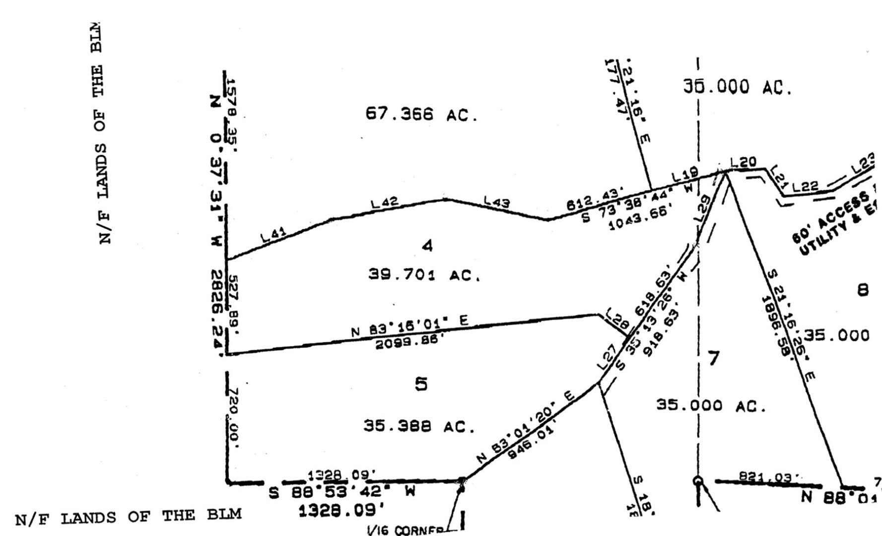
Plat and Survey Map
As you can see from the photos and maps, the western edge of the property forms a curved ridge with a dramatic 200’ rise in elevation creating a cliff. Thousands of years of cliff erosion at the northwestern edge of the curve created a large natural bowl formation, which is considered especially auspicious by practitioners of feng shui.

Although we currently have no knowledge of underground reservoirs, we do have evidence of a tremendous amount of (surface) groundwater. Some of the creek beds have walls over eight feet high, so it is quite apparent that at various times a great deal of water has rushed out of the mountains; not only carving the landscape but covering it in anywhere from one to eight inches of sand and carrying boulders to rest in the dry creek beds that criss-cross the land.